A particularly valuable discovery has turned our knowledge of Stonehenge upside down. On the most researched site in the world, a research group including a few Ghent University researchers has found traces that are much older than anything that has been excavated so far. We know that there are still secrets to be uncovered from bio-engineer Philippe De Smedt, among other things thanks to soil scans.
“We have discovered unprecedented prehistoric traces in Stonehenge, covering a period from the end of the last Ice Age, some 10,000 years ago, to the Middle Bronze Age”, according to Philippe De Smedt.
Oldest traces ever discovered
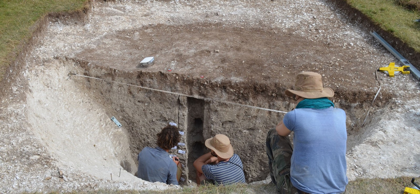
The traces date from the early hunter-gatherers at the beginning of the Holocene to farmers in the late Bronze Age. A period spanning no less than 7,000 years. One of the traces is particularly remarkable: a round pit measuring 4 meters wide and 2 meters deep, excavated in the chalk rock. The shape of the pit suggests that it served as a trap to catch large game. The pit dates from about 8000 B.C.
“That’s the time when the south of Great Britain became reinhabited by hunter-gatherers following the last Ice Age”, explains Koen Deforce, co-researcher and professor in the Archaeology department. “Of the few known Stone Age sites around Stonehenge, this pit is among the oldest, and the most precisely dated. It also appears to be one of the largest archaeological traces from the early Stone Age in North-West Europe.”
From Sinaai to Stonehenge
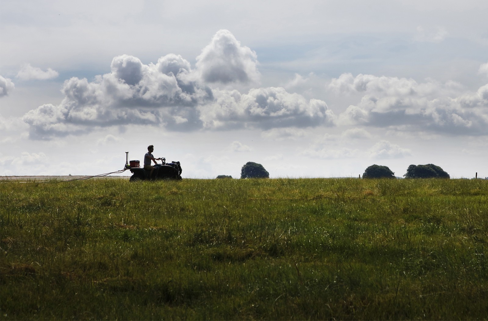
Amazing results, for which the first steps were taken in Sinaai in 2014. The year in which Philippe took off to Klein Sinaai with a quad and a soil scanner. He developed this scanner himself, in an effort to gain a new approach to archaeology: using 3-D soil reconstruction. A single drive over the terrain immediately reveals all kinds of information about the landscape back in the Middle Ages.
“This soil sensor can measure both underground magnetic and electric variations simultaneously,” explains Philippe. “Such variations contain information about natural soil layers, but also about human activity. For example, in the scans we can find traces of ditches and pits, or determine where things were burned, as this disturbs the soil layers.”
Philippe contacted his colleagues in the Archaeology department. Together they did some targeted excavations. They aligned the maps from the soil scanner with archaeological data and in doing so were able to reconstruct a 3-D landscape of Klein Sinaai during the Middle Ages, including Boudelo Abbey .
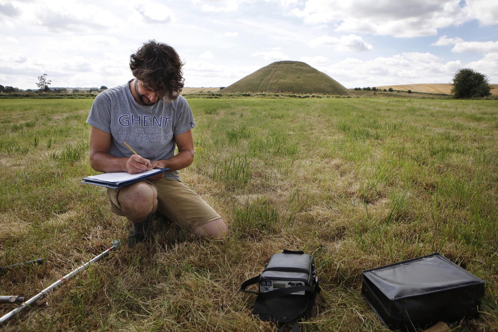
The research was noticed and turned out to be the perfect stepping stone to the bigger task: Stonehenge. There, the researchers will meticulously map an area covering 2.5 square kilometres. They will work together with the Geology department in Ghent and the University of Birmingham. Together, the team is keen to investigate which traces from prehistoric times have so far been hidden from the many archaeologists who have studied the landscape.
More difficult archaeology
“It is an exceptional privilege to do research in Stonehenge ”, says Philippe. “The area has an enormously rich history, dating mainly from the Stone Age to the early Bronze Age (around 5000 to 3000 years ago). As such, Stonehenge is one of the most researched archaeological landscapes in the world. The stone circle and its broad surroundings – a total of about 25 square kilometres – is recognised by UNESCO as a world heritage site. This means that the many monuments are protected by the British government. It is therefore very hard to get permission to do fieldwork.”
Koen Deforce (Archaeology department): “Our focus did not lie on the many Stonehenge monuments, but instead on more subtle traces of the past: remains of short prehistoric rituals, or traces of how people used the land even before the monuments were erected.”
“The stone circle and the monuments we still see today in the Stonehenge landscape are actually just the tip of the iceberg”, continues Philippe. “We know that the area was used for millennia during prehistoric times. However, scientists have long viewed the landscape from a one-sided perspective, as until now they have mainly focused on traditional archaeology. We were keen to discover the 'more difficult' archaeology.”
Combination of disciplines
In the first place, the team will look for material with which they can reconstruct prehistoric environmental changes. After all, such information struggles to survive in the shallow soils of Stonehenge, making it necessary to look for cavities and cracks in the subsoil in which remains of plants have been better preserved. Such research is only possible by combining different disciplines.
Philippe explains how the process works: “We start with soil scans. We pour that data into geophysical maps, which we then use to decide where to take soil samples. With this information, we make computer models with which we can look for specific types of archaeological traces.”
The models of Stonehenge showed hundreds of large pits in the landscape. The researchers suspected that these were dug by those using the landscape in prehistoric times. To check the models and complete their interpretation, the team dug up twenty sites. They took samples allowing them to conclude the chronological and ecological context of the traces. This led to results that will go around the world.
A visit from the rectors
On 12 May, Philippe is returning to Stonehenge, together with rectors from the Flemish universities. He will present the results of this impressive piece of teamwork.
“We are very fortunate to be able to do this research is such a unique setting as Stonehenge”, recognises Philippe. “Thanks to this project, we have been able to make it clear that the combination of different techniques can be a huge enrichment for archaeological research, and uncover unknown things – even in an area as intensively explored as Stonehenge.”
(photos: Layla Aerts)
Read also
The landscape as a trail to missing soldiers from WWI
After the First World War, tens of thousands of soldiers remained missing in the earth in the Westhoek. Some are now recovering their identity at the In the Flanders Fields Museum. Ghent University archaeologist, Birger Stichelbaut, teamed up with Ghent University alumnus, Simon Verdegem, to lay the foundations for the captivating exhibition. The result of excavation work and archaeology from the air.

Atlantis in Bruges: reconstruction of lost medieval ports
These days it is mainly a tourist attraction, but Bruges was once an international world city, like London or Shanghai. The reason? Its many outer ports in the Zwin channel. New archaeological, historical and geological research has now made it possible to reconstruct that past in an unprecedented manner.

Ghent University historian discovers site of Medieval metropolis?
Historian John Latham Sprinkle discovered quite by chance the location of the lost city of Magas, as the capital of the medieval kingdom of Alania. Although it might not be. In fact, you can never be sure, according to John Latham Sprinkle.

One master, many directions: archeology
Three alumni look back at their time in education and the road they eventually chose. In effect, even though they started on the same path, it took them to different places. Caroline Landsheere, Anja Goethals and Bas Bogaerts all studied archaeology. The passion for the past is still there, even though it doesn’t play as big a role as before for each of them.
